By train
You can find the best connection for you via the DB Navigator.
You can also enter the bus/train stop "Universität Süd" here; of course, you can also enter any of the other 5 public transport stops on campus. Since the names of the stops also occur in other cities, you should add ", Ulm" to the stop name.
Ulm main station - OSM-location - is a point of intersection
- for numerous train lines (see above: Details on transport connections). It is
- frequented by several bus lines and
- currently one tram and tram lines and
- serves as central bus station (ZOB) for regional bus lines.
This makes it the most important public transport hub in the city.
Tram line 2 and bus line 5 both connect the main station with the campus.
- Travel time is approx. 10 to 20 minutes. Your specific destination on the ca. 1.5 km long campus determines which of the 5 stops is best for you, and thus your travel time.
- Both lines serve all stops.
- Both lines run every 10 minutes on workdays; during lecture periods tram line 2 even runs every 3-5 minutes during peak hours.
Overview of the various stops at the main station (download)
With the free DING-App for iPhone and android you can check the departure times of each line at individual stops.
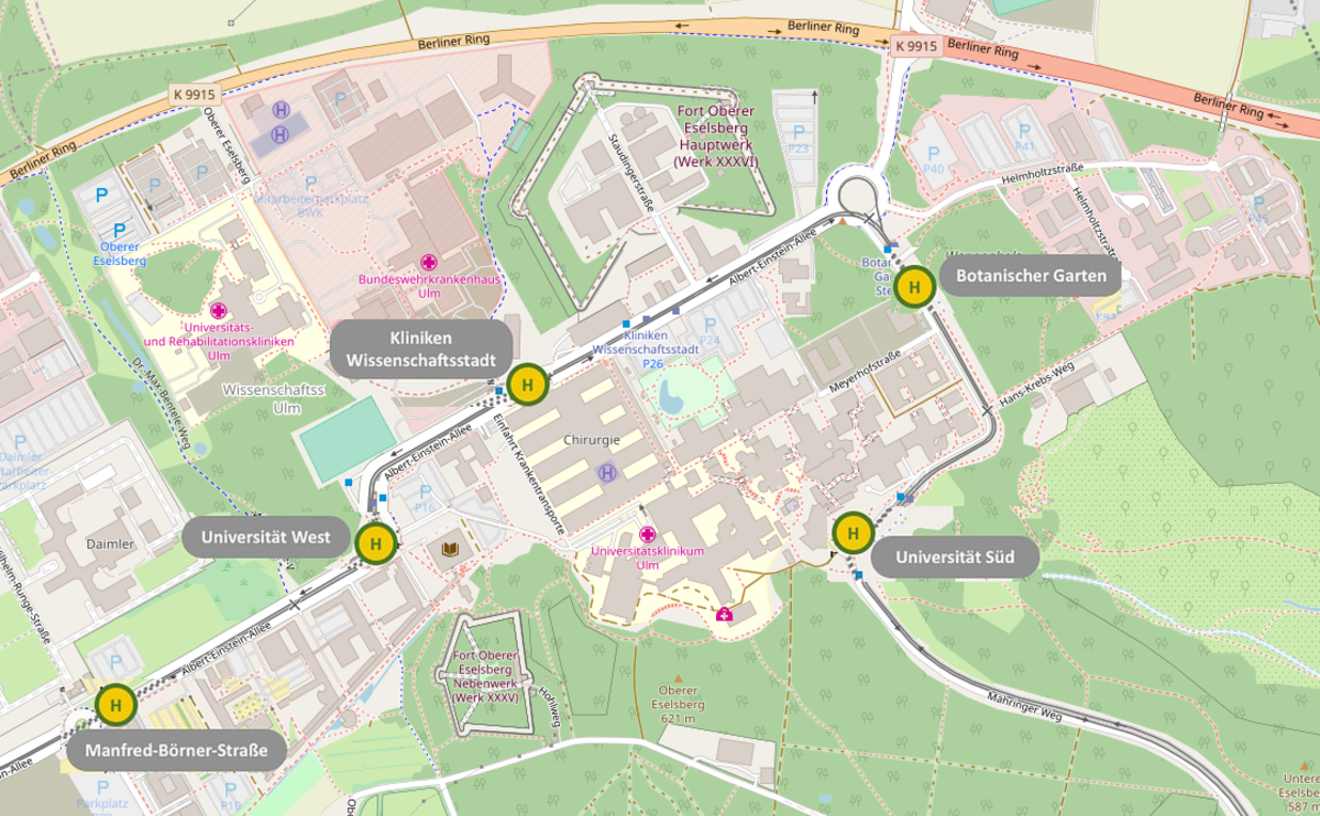
| Name of the stop* | Approximate target area on campus |
| Universität Süd | Uni East | South entrance |
| Botanischer Garten | Uni-East | access areas from East; University Administration; Botanical Garden |
| Kliniken Wissenschaftsstadt | university hospital, military hospital (BWK), rehabilitation hospital (RKU) |
| Universität West | Uni West | Albert-Einstein-Allee 37 to 43 |
| Manfred-Börner-Straße | Uni West | Albert-Einstein-Allee 43 to 47 |
| *linked to OSM |